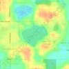
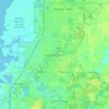
Topografische kaart Zephyrhills
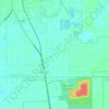
Klik op de kaart om de hoogte weer te geven.
Zephyrhills
Zephyrhills is known for its rolling topography, hence the name.
Over deze kaart

Naam: Topografische kaart Zephyrhills, hoogte, reliëf.
Locatie: Zephyrhills, Pasco County, Florida, United States (28.19696 -82.24174 28.28826 -82.14495)
Gemiddelde hoogte: 32 m
Minimale hoogte: 17 m
Maximale hoogte: 71 m
Andere topografische kaarten
Klik op een kaart om zijn topografie, zijn hoogte en zijn reliëf te bekijken.


Wesley Chapel
United States > Florida > Pasco County
According to the United States Census Bureau, the CDP has a total area of 6.1 square miles (16 km2), of which 6.1 square miles (16 km2) is land and 0.04 square miles (0.10 km2) (0.49%) is water. The elevation is about 100 feet (30 m), combined with an inland location, creates more temperature variation in the…
Gemiddelde hoogte: 19 m




Wesley Chapel
United States > Florida > Pasco County
According to the United States Census Bureau, the CDP has a total area of 6.1 square miles (16 km2), of which 6.1 square miles (16 km2) is land and 0.04 square miles (0.10 km2) (0.49%) is water. The elevation is about 100 feet (30 m), combined with an inland location, creates more temperature variation in the…
Gemiddelde hoogte: 19 m

Wesley Chapel
United States > Florida > Pasco County
According to the United States Census Bureau, the CDP has a total area of 6.1 square miles (16 km2), of which 6.1 square miles (16 km2) is land and 0.04 square miles (0.10 km2) (0.49%) is water. The elevation is about 100 feet (30 m), combined with an inland location, creates more temperature variation in the…
Gemiddelde hoogte: 19 m