
Topografische kaart Las Casas
Interactieve kaart
Klik op de kaart om de hoogte weer te geven.
Over deze kaart
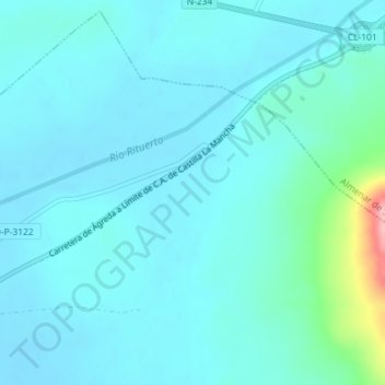
Naam: Topografische kaart Las Casas, hoogte, reliëf.
Locatie: Las Casas, Buberos, Gómara, Castilla y León, España (41.65059 -2.16870 41.67059 -2.14870)
Gemiddelde hoogte: 1.017 m
Minimale hoogte: 997 m
Maximale hoogte: 1.154 m