
Topografische kaart Junagadh
Interactieve kaart
Klik op de kaart om de hoogte weer te geven.
Over deze kaart
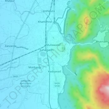
Naam: Topografische kaart Junagadh, hoogte, reliëf.
Gemiddelde hoogte: 163 m
Minimale hoogte: 54 m
Maximale hoogte: 853 m
Junagadh city is located at 21°31′N 70°28′E / 21.52°N 70.47°E / 21.52; 70.47 at the foot of Mount Girnar, with the Arabian sea to the southwest, Porbandar to the north, and Amreli to the east. It has an average elevation of 107 metres (351 ft).