
Topografische kaart Roche Béranger
Interactieve kaart
Klik op de kaart om de hoogte weer te geven.
Over deze kaart
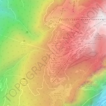
Naam: Topografische kaart Roche Béranger, hoogte, reliëf.
Gemiddelde hoogte: 1.561 m
Minimale hoogte: 539 m
Maximale hoogte: 2.250 m
The road to the ski station starts at Uriage-les-Bains from where the climb is 19 km (12 mi) long, gaining 1,235 m (4,052 ft) in elevation, at an average gradient of 6.5%. There are several sections in excess off 11% in the early stages of the climb. For the Tour de France, the summit is at an elevation of 1,730 m (5,680 ft).