Geolokaliseren

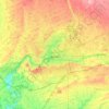
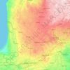
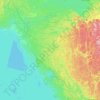
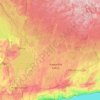
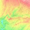
Topografische kaart Lanark County

Klik op de kaart om de hoogte weer te geven.

Over deze kaart

Naam: Topografische kaart Lanark County, hoogte, reliëf.

Locatie: Lanark County, Eastern Ontario, Ontario, Canada (44.70290 -76.76908 45.40939 -75.81597)

Gemiddelde hoogte: 167 m

Minimale hoogte: 53 m

Maximale hoogte: 385 m

Andere topografische kaarten

Klik op een kaart om zijn topografie, zijn hoogte en zijn reliëf te bekijken.
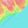
Toronto

Canada > Ontario > Toronto

Despite its deep ravines, Toronto is not remarkably hilly, but its elevation does increase steadily away from the lake. Elevation differences range from 76.5 metres (251 ft) above sea level at the Lake Ontario shore to 209 m (686 ft) ASL near the York University grounds in the city's north end at the…

Gemiddelde hoogte: 113 m
Hamilton

Canada > Ontario > Hamilton

Gemiddelde hoogte: 181 m

London

Canada > Ontario > London > London

London has a humid continental climate (Köppen Dfb), though due to its downwind location relative to Lake Huron and elevation changes across the city, it is virtually on the Dfa/Dfb (hot summer) boundary favouring the former climate zone to the southwest of the confluence of the South and North Thames Rivers,…

Gemiddelde hoogte: 268 m
Kingston

Canada > Ontario > Kingston

Gemiddelde hoogte: 94 m

Ottawa

Canada > Ontario > Ottawa > Ottawa

Gemiddelde hoogte: 99 m

Windsor

Canada > Ontario > Windsor

Gemiddelde hoogte: 185 m

High Park

Canada > Ontario > Toronto

Gemiddelde hoogte: 97 m

Cherry Beach

Canada > Ontario > Toronto

Gemiddelde hoogte: 74 m

Guelph

Canada > Ontario > Guelph

This region of Ontario has cold winters and warm, humid summers, falling into the Köppen climate classification Dfb zone, with moderately high rainfall and snowfall. It is generally a couple of degrees cooler than lower elevation regions on the Great Lakes shorelines, especially so in winter, the exception…

Gemiddelde hoogte: 344 m
Belleville

Canada > Ontario > Belleville

Gemiddelde hoogte: 107 m

Peterborough

Canada > Ontario > Peterborough

Peterborough's topography is largely defined by land formations created by the receding Wisconsian glaciers 10,000–15,000 years ago. The South End and Downtown portions of the City sit on what was the bottom of the glacial Lake Peterborough—part of a glacial spillway created when glacial meltwaters from…

Gemiddelde hoogte: 235 m

Pinehurst Lake

Canada > Ontario

Gemiddelde hoogte: 295 m

Rouge National Urban Park

Canada > Ontario > Toronto

Gemiddelde hoogte: 143 m

Don River

Canada > Ontario > Toronto

Gemiddelde hoogte: 80 m

Kawartha Lakes

Canada > Ontario > Kawartha Lakes

Gemiddelde hoogte: 269 m

Minden

Canada > Ontario > Haliburton County > Minden Hills

Gemiddelde hoogte: 320 m

Kaministiquia River

Canada > Ontario > Thunder Bay

Gemiddelde hoogte: 249 m

Niagara Escarpment

Canada > Ontario > Hamilton

Gemiddelde hoogte: 162 m

Bonfield

Canada > Ontario > Nipissing District

Gemiddelde hoogte: 259 m

Perth

Canada > Ontario

Gemiddelde hoogte: 313 m

Port Dover

Canada > Ontario > Norfolk County

Gemiddelde hoogte: 187 m

Dundas

Canada > Ontario > Hamilton > Dundas

Dundas /ˈdʌnˌdæs/ is a community and former town in Hamilton, Ontario, Canada. It is nicknamed the Valley Town because of its topographical location at the bottom of the Niagara Escarpment on the western edge of Lake Ontario. The population has been stable for decades at about twenty thousand, largely…

Gemiddelde hoogte: 171 m

Sagamok

Canada > Ontario

Gemiddelde hoogte: 210 m

Niagara Escarpment

Canada > Ontario

Gemiddelde hoogte: 299 m

York River

Canada > Ontario

Gemiddelde hoogte: 397 m

Christie Pits Park

Canada > Ontario > Old Toronto

Gemiddelde hoogte: 117 m

Pefferlaw

Canada > Ontario > York Region > Georgina

Gemiddelde hoogte: 231 m

New Glasgow

Canada > Ontario > Elgin County > West Elgin

Gemiddelde hoogte: 199 m

Port Dover

Canada > Ontario > Norfolk County

Gemiddelde hoogte: 187 m

Haliburton

Canada > Ontario

Gemiddelde hoogte: 358 m

Brantford

Canada > Ontario > Brantford

Gemiddelde hoogte: 238 m

Kenora

Canada > Ontario

Gemiddelde hoogte: 182 m

French River

Canada > Ontario > Sudbury District

Gemiddelde hoogte: 208 m

Mono Mills

Canada > Ontario > Peel Region > Caledon

Gemiddelde hoogte: 422 m

Markdale

Canada > Ontario > Grey County > Grey Highlands

Gemiddelde hoogte: 421 m

Elora

Canada > Ontario > Wellington County > Centre Wellington

Gemiddelde hoogte: 395 m

Bruce Peninsula

Canada > Ontario > Grey County > Georgian Bluffs

Gemiddelde hoogte: 240 m

Constance Bay

Canada > Ontario > Ottawa

Gemiddelde hoogte: 65 m

Beamsville

Canada > Ontario > Niagara Region

Gemiddelde hoogte: 134 m

Jock River

Canada > Ontario > Ottawa

Gemiddelde hoogte: 98 m

Georgetown

Canada > Ontario > Halton Region

Gemiddelde hoogte: 255 m

Frontenac Provincial Park

Canada > Ontario > South Frontenac

Frontenac Provincial Park is located near the town of Sydenham, north of the city of Kingston, Ontario, Canada. The Government of Ontario has classified Frontenac Provincial Park as a natural environment park. The park lies on the Frontenac Axis, a topographic extension of the Canadian Shield, which connects…

Gemiddelde hoogte: 151 m

Manilla

Canada > Ontario > Kawartha Lakes

Gemiddelde hoogte: 295 m

Honeywood

Canada > Ontario > Dufferin County > Mulmur

Gemiddelde hoogte: 505 m

Angus

Canada > Ontario > Simcoe County > Essa

Gemiddelde hoogte: 199 m

Chatham

Canada > Ontario > Chatham-Kent

Gemiddelde hoogte: 182 m

Watford

Canada > Ontario > Watford

Gemiddelde hoogte: 237 m

Caledon East

Canada > Ontario > Peel Region > Caledon

Gemiddelde hoogte: 308 m

Alban

Canada > Ontario > Sudbury District > French River

Gemiddelde hoogte: 206 m

Scotland

Canada > Ontario > Brant County

Gemiddelde hoogte: 251 m

Chedoke Creek

Canada > Ontario > Hamilton

Gemiddelde hoogte: 93 m

Point Pelee

Canada > Ontario > Essex County > Leamington

Gemiddelde hoogte: 172 m

Erie Beach

Canada > Ontario > Chatham-Kent

Gemiddelde hoogte: 179 m

Port Stanley

Canada > Ontario > Elgin County > Central Elgin

Gemiddelde hoogte: 192 m

Long Point

Canada > Ontario > Norfolk County

Gemiddelde hoogte: 173 m

Woodbine Beach

Canada > Ontario > Old Toronto

Gemiddelde hoogte: 78 m

Udora

Canada > Ontario > York Region > Georgina

Gemiddelde hoogte: 244 m

Pinery Park

Canada > Ontario > Halton Region > Oakville

Gemiddelde hoogte: 162 m

Port Bruce

Canada > Ontario > Elgin County

Gemiddelde hoogte: 185 m

Tottenham

Canada > Ontario > Simcoe County

Gemiddelde hoogte: 274 m

Cambridge

Canada > Ontario > Cambridge

Gemiddelde hoogte: 295 m

Prince Edward

Canada > Ontario

Gemiddelde hoogte: 118 m

Lambton

Canada > Ontario

Gemiddelde hoogte: 188 m

Parry Sound

Canada > Ontario

Gemiddelde hoogte: 235 m

Essex

Canada > Ontario

Gemiddelde hoogte: 193 m

Dorset

Canada > Ontario > Muskoka District

Gemiddelde hoogte: 353 m

St. Thomas

Canada > Ontario > St. Thomas

Gemiddelde hoogte: 231 m
Welland River

Canada > Ontario > West Lincoln

Gemiddelde hoogte: 181 m

Lac Seul

Canada > Ontario

Gemiddelde hoogte: 365 m

Harlem Shoal

Canada > Ontario

Gemiddelde hoogte: 175 m

St. Johns

Canada > Ontario

Gemiddelde hoogte: 205 m

Quetico Provincial Park

Canada > Ontario

Gemiddelde hoogte: 432 m

Ohsweken

Canada > Ontario

Gemiddelde hoogte: 208 m

Docker Lake

Canada > Ontario

Gemiddelde hoogte: 377 m

Hamilton Mountain

Canada > Ontario > Hamilton

Gemiddelde hoogte: 164 m

Oneida Nation of the Thames

Canada > Ontario

Gemiddelde hoogte: 224 m

Bigwin Island

Canada > Ontario

Gemiddelde hoogte: 328 m

Upper Pergeon Lake

Canada > Ontario

Gemiddelde hoogte: 215 m

Kawartha Lakes (city)

Canada > Ontario

Gemiddelde hoogte: 274 m

Milton

Canada > Ontario > Halton Region > Milton

Gemiddelde hoogte: 217 m

Pelee Island

Canada > Ontario

Gemiddelde hoogte: 173 m

Quinte West (city)

Canada > Ontario

Gemiddelde hoogte: 160 m

South Baymouth

Canada > Ontario > Manitoulin District

Gemiddelde hoogte: 178 m

London

Canada > Ontario

London has a humid continental climate (Köppen Dfb), though due to its downwind location relative to Lake Huron and elevation changes across the city, it is virtually on the Dfa/Dfb (hot summer) boundary favouring the former climate zone to the southwest of the confluence of the South and North Thames Rivers,…

Gemiddelde hoogte: 269 m

Lambton

Canada > Ontario

Gemiddelde hoogte: 191 m

Algoma District

Canada > Ontario

Gemiddelde hoogte: 360 m

London (city)

Canada > Ontario

Gemiddelde hoogte: 239 m

Mansfield

Canada > Ontario > Dufferin County > Mulmur

Gemiddelde hoogte: 318 m

Rust jezelf uit voor je volgende avontuur:

💧Drinkflessen & Bidons - Duurzame en lekvrije flessen voor hydratatie
🧭Outdoor Navigatie - Alles voor oriëntatie in de natuur
🧤Outdoor Handschoenen - Handschoenen voor bescherming tegen kou en wind
🧗Wandelstokken - Ergonomische stokken voor lange afstanden
⛺Lichtgewicht Tenten - Compacte tenten voor backpacken en kamperen

Als Amazon-partner verdient deze site een commissie op in aanmerking komende aankopen, zonder extra kosten voor jou.