
Topografische kaart Vessey
Interactieve kaart
Klik op de kaart om de hoogte weer te geven.
Over deze kaart
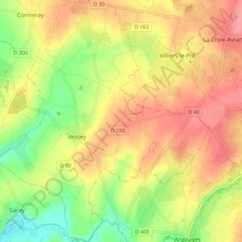
Naam: Topografische kaart Vessey, hoogte, reliëf.
Gemiddelde hoogte: 56 m
Minimale hoogte: 12 m
Maximale hoogte: 90 m
Andere topografische kaarten
Klik op een kaart om zijn topografie, zijn hoogte en zijn reliëf te bekijken.
La Caserne
France > Normandie > Manche > Pontorson
La Caserne, Ardevon, Pontorson, Avranches, Manche, Normandie, France métropolitaine, 50170, France
Gemiddelde hoogte: 6 m
Les Hautes Rivières
France > Normandie > Manche > Pontorson
Les Hautes Rivières, Moidrey, Pontorson, Avranches, Manche, Normandie, France métropolitaine, 50170, France
Gemiddelde hoogte: 21 m