
Topografische kaart Parque Natural de las Marismas de Santoña, Victoria y Joyel
Interactieve kaart
Klik op de kaart om de hoogte weer te geven.
Over deze kaart
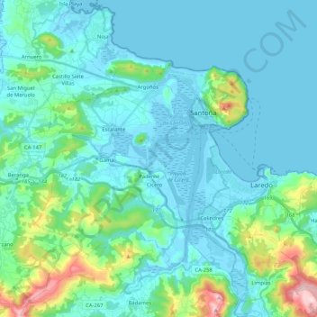
Naam: Topografische kaart Parque Natural de las Marismas de Santoña, Victoria y Joyel, hoogte, reliëf.
Gemiddelde hoogte: 74 m
Minimale hoogte: -3 m
Maximale hoogte: 500 m