
Topografische kaart Bintan Island
Interactieve kaart
Klik op de kaart om de hoogte weer te geven.
Over deze kaart
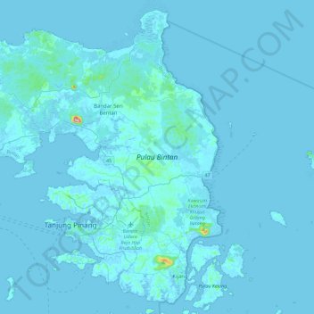
Naam: Topografische kaart Bintan Island, hoogte, reliëf.
Locatie: Bintan Island, Tanjung Pinang, Riau Islands, Indonesia (0.80927 104.21379 1.22982 104.66002)
Gemiddelde hoogte: 6 m
Minimale hoogte: -4 m
Maximale hoogte: 323 m