
Topografische kaart Kai Kung Shan
Interactieve kaart
Klik op de kaart om de hoogte weer te geven.
Over deze kaart
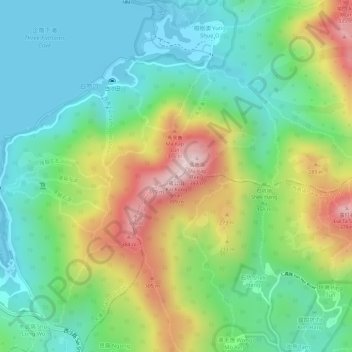
Naam: Topografische kaart Kai Kung Shan, hoogte, reliëf.
Gemiddelde hoogte: 135 m
Minimale hoogte: -1 m
Maximale hoogte: 366 m
Andere topografische kaarten
Klik op een kaart om zijn topografie, zijn hoogte en zijn reliëf te bekijken.
Ting Kok
China > Hong Kong > Tai Po District > Ting Kok Village
Ting Kok, Plover Cove, Ting Kok Village, Tai Po District, New Territories, Hong Kong, China
Gemiddelde hoogte: 121 m
Pyramid Hill
China > Hong Kong > Tai Po District
Pyramid Hill, Tai Po District, New Territories, Hong Kong, China
Gemiddelde hoogte: 284 m
Tai Po
China > Hong Kong > Tai Po District
Tai Po, Tai Po District, New Territories, Hong Kong, China
Gemiddelde hoogte: 155 m