
Topografische kaart Pawnee
Interactieve kaart
Klik op de kaart om de hoogte weer te geven.
Over deze kaart
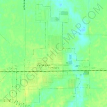
Naam: Topografische kaart Pawnee, hoogte, reliëf.
Locatie: Pawnee, Sangamon County, Illinois, United States (39.58212 -89.60515 39.60893 -89.56741)
Gemiddelde hoogte: 183 m
Minimale hoogte: 174 m
Maximale hoogte: 189 m
Andere topografische kaarten
Klik op een kaart om zijn topografie, zijn hoogte en zijn reliëf te bekijken.
Jerome
United States > Illinois > Sangamon County
Jerome, Sangamon County, Illinois, United States
Gemiddelde hoogte: 185 m
Divernon
United States > Illinois > Sangamon County
Divernon, Sangamon County, Illinois, 62530, United States
Gemiddelde hoogte: 187 m
Grandview
United States > Illinois > Sangamon County
Grandview, Sangamon County, Illinois, United States
Gemiddelde hoogte: 183 m
Auburn
United States > Illinois > Sangamon County
Auburn, Sangamon County, Illinois, 62615, United States
Gemiddelde hoogte: 191 m
Chatham
United States > Illinois > Sangamon County
Chatham, Sangamon County, Illinois, 62629, United States
Gemiddelde hoogte: 183 m
Bates
United States > Illinois > Sangamon County
Bates, Sangamon County, Illinois, 62670, United States
Gemiddelde hoogte: 194 m
Springfield
United States > Illinois > Sangamon County
Springfield, Sangamon County, Illinois, United States
Gemiddelde hoogte: 178 m
Rochester
United States > Illinois > Sangamon County > Rochester
Rochester, Sangamon County, Illinois, United States
Gemiddelde hoogte: 175 m
Williamsville
United States > Illinois > Sangamon County > Williamsville
Williamsville, Sangamon County, Illinois, 62693, United States
Gemiddelde hoogte: 177 m
Buffalo
United States > Illinois > Sangamon County > Buffalo
Buffalo, Sangamon County, Illinois, United States
Gemiddelde hoogte: 184 m
Riverton
United States > Illinois > Sangamon County
Riverton, Sangamon County, Illinois, 62651, United States
Gemiddelde hoogte: 171 m