
Topografische kaart Allanton
Interactieve kaart
Klik op de kaart om de hoogte weer te geven.
Over deze kaart
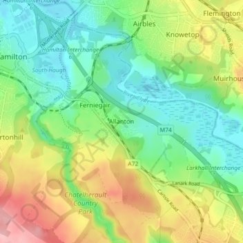
Naam: Topografische kaart Allanton, hoogte, reliëf.
Locatie: Allanton, South Lanarkshire, Scotland, ML3 7TY, United Kingdom (55.74524 -4.02100 55.78524 -3.98100)
Gemiddelde hoogte: 66 m
Minimale hoogte: 20 m
Maximale hoogte: 144 m