
Topografische kaart Schauinsland
Interactieve kaart
Klik op de kaart om de hoogte weer te geven.
Over deze kaart
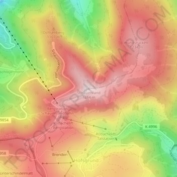
Naam: Topografische kaart Schauinsland, hoogte, reliëf.
Gemiddelde hoogte: 1.068 m
Minimale hoogte: 740 m
Maximale hoogte: 1.279 m
The Schauinsland (literally "look-into-the-country"; near Freiburg im Breisgau, Germany) is a mountain in the Black Forest with an elevation of 1,284 m (4,213 ft) above sea level. It is a popular destination for day trips. Due to the high amount of silver mining, it was previously known as "Erzkasten" (literally "ore box"); the name "Schouwesland" first appeared in 1347. The mountain is located roughly ten kilometres (6.2 miles) south-east of Freiburg's city centre.