
Topografische kaart Batticaloa
Interactieve kaart
Klik op de kaart om de hoogte weer te geven.
Batticaloa
Batticaloa is in the eastern coast of Sri Lanka on a flat coastal plain boarded by the Indian Ocean in the east occupies a central part of the eastern Sri Lanka. Its average elevation is around 5 meters. Batticaloa district has three lagoons such as Batticaloa Lagoon, Valaichchenai Lagoon, and Vakari (Panichchankerni) Lagoon. Among these lagoon, Batticaloa Lagoon is the largest lagoon and has 56 km long 162 square km area, extending from Pankudaweli in North and Kalmunai in South.
Over deze kaart
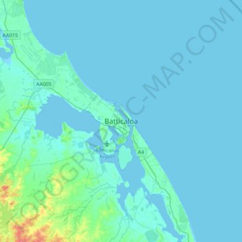
Naam: Topografische kaart Batticaloa, hoogte, reliëf.
Gemiddelde hoogte: 5 m
Minimale hoogte: -2 m
Maximale hoogte: 67 m