
Topografische kaart Calantas
Interactieve kaart
Klik op de kaart om de hoogte weer te geven.
Over deze kaart
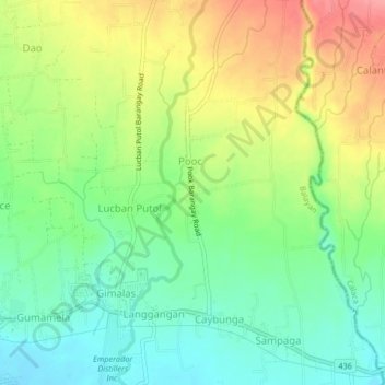
Naam: Topografische kaart Calantas, hoogte, reliëf.
Locatie: Calantas, Batangas, Calabarzon, 4213, Philippines (13.93813 120.73781 13.97813 120.77781)
Gemiddelde hoogte: 42 m
Minimale hoogte: 5 m
Maximale hoogte: 95 m