
Topografische kaart Sierra Negra
Interactieve kaart
Klik op de kaart om de hoogte weer te geven.
Sierra Negra
Sierra Negra is located within the Pico de Orizaba National Park. The mountain is the site for two of the world's premier astronomical instruments, the Large Millimeter Telescope and the High Altitude Water Cherenkov Observatory. Therefore, the access to the mountain is restricted and has to be applied for at least a week in advance. The service road for this facility is claimed to be the highest road in North America. A part of the telescope facility is visible as a white dot in the first picture below and more clearly in the second picture.
Over deze kaart
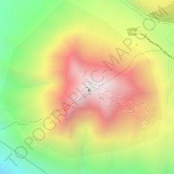
Naam: Topografische kaart Sierra Negra, hoogte, reliëf.
Locatie: Sierra Negra, Chalchicomula de Sesma, Puebla, Mexico (18.98616 -97.31515 18.98626 -97.31505)
Gemiddelde hoogte: 4.099 m
Minimale hoogte: 3.534 m
Maximale hoogte: 4.575 m