
Topografische kaart Mount Mitchell State Park
Interactieve kaart
Klik op de kaart om de hoogte weer te geven.
Over deze kaart
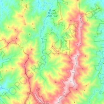
Naam: Topografische kaart Mount Mitchell State Park, hoogte, reliëf.
Gemiddelde hoogte: 1.274 m
Minimale hoogte: 786 m
Maximale hoogte: 2.019 m