Geolokaliseren

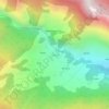
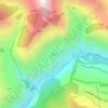
Topografische kaart Mana

Klik op de kaart om de hoogte weer te geven.

Over deze kaart

Naam: Topografische kaart Mana, hoogte, reliëf.

Locatie: Mana, Joshimath Tehsil, Chamoli, Uttarakhand, India (30.96600 79.40952 30.96818 79.41237)

Gemiddelde hoogte: 4.959 m

Minimale hoogte: 4.624 m

Maximale hoogte: 5.575 m

Andere topografische kaarten

Klik op een kaart om zijn topografie, zijn hoogte en zijn reliëf te bekijken.

Dunagiri

India > Uttarakhand > Joshimath Tehsil

Gemiddelde hoogte: 6.059 m

Malari

India > Uttarakhand > Joshimath Tehsil

Gemiddelde hoogte: 3.458 m

Tugasi

India > Uttarakhand > Joshimath Tehsil

Gemiddelde hoogte: 2.785 m

Joshimath

India > Uttarakhand > Joshimath Tehsil

Gemiddelde hoogte: 2.272 m

Garpak

India > Uttarakhand > Joshimath Tehsil

Gemiddelde hoogte: 3.646 m

Nanda Devi

India > Uttarakhand > Joshimath Tehsil

Gemiddelde hoogte: 6.567 m

Tapoban

India > Uttarakhand > Joshimath Tehsil

Gemiddelde hoogte: 2.287 m

Bamba

India > Uttarakhand > Joshimath Tehsil > Pharkia

Gemiddelde hoogte: 3.731 m

Dhak

India > Uttarakhand > Joshimath Tehsil

Gemiddelde hoogte: 2.373 m

Saraswati

India > Uttarakhand > Joshimath Tehsil > Mana

Gemiddelde hoogte: 5.393 m

Urgam

India > Uttarakhand > Joshimath Tehsil

Gemiddelde hoogte: 2.351 m

Badrinath

India > Uttarakhand > Joshimath Tehsil

Gemiddelde hoogte: 4.052 m

Auli

India > Uttarakhand > Joshimath Tehsil

Gemiddelde hoogte: 2.438 m

Kamet

India > Uttarakhand > Joshimath Tehsil

Gemiddelde hoogte: 6.701 m

Trisul I

India > Uttarakhand > Joshimath Tehsil

Gemiddelde hoogte: 6.343 m

Pangarchulla

India > Uttarakhand > Joshimath Tehsil

Gemiddelde hoogte: 4.061 m

Ghangaria

India > Uttarakhand > Joshimath Tehsil

Ghangaria is a village in Uttarakhand state of India. It is located at an altitude of 3049 meters.

Gemiddelde hoogte: 3.740 m

Saldhar

India > Uttarakhand > Joshimath Tehsil > Subhain

Gemiddelde hoogte: 2.563 m

Hathi Parbat

India > Uttarakhand > Joshimath Tehsil

Hathi Parbat, also known as Elephant Peak, is a mountain in the Garhwal Himalayas in India. It is located in the Chamoli district of Uttarakhand state. Its summit has an elevation of 6,727 metres (22,070 ft).

Gemiddelde hoogte: 5.975 m

Gauri Parbat

India > Uttarakhand > Joshimath Tehsil

Gemiddelde hoogte: 5.754 m

Hanuman

India > Uttarakhand > Joshimath Tehsil

Gemiddelde hoogte: 5.370 m

Changabang

India > Uttarakhand > Joshimath Tehsil

Gemiddelde hoogte: 5.804 m

Shambhu Ka Qilla

India > Uttarakhand > Joshimath Tehsil

Gemiddelde hoogte: 5.634 m

Tirsuli West

India > Uttarakhand > Joshimath Tehsil

Gemiddelde hoogte: 6.195 m

Kamet

India > Uttarakhand > Joshimath Tehsil

Gemiddelde hoogte: 6.701 m

Mana NW

India > Uttarakhand > Joshimath Tehsil

Gemiddelde hoogte: 6.473 m

Songhangra

India > Uttarakhand > Joshimath Tehsil

Gemiddelde hoogte: 4.240 m

Shambhu Ka Qilla

India > Uttarakhand > Joshimath Tehsil

Gemiddelde hoogte: 5.634 m

Kalanka

India > Uttarakhand > Joshimath Tehsil

Gemiddelde hoogte: 5.938 m

Pangarchulla

India > Uttarakhand > Joshimath Tehsil

Gemiddelde hoogte: 4.061 m

Uja Tirche

India > Uttarakhand > Joshimath Tehsil

Gemiddelde hoogte: 5.428 m

Nanda Devi

India > Uttarakhand > Joshimath Tehsil

Gemiddelde hoogte: 6.567 m

Tirsuli

India > Uttarakhand > Joshimath Tehsil

Gemiddelde hoogte: 6.244 m

Tirsuli

India > Uttarakhand > Joshimath Tehsil

Gemiddelde hoogte: 6.244 m

Niti

India > Uttarakhand > Joshimath Tehsil

Gemiddelde hoogte: 3.986 m

Joshimath

India > Uttarakhand > Joshimath Tehsil

Gemiddelde hoogte: 2.272 m

Gamshali

India > Uttarakhand > Joshimath Tehsil

Gemiddelde hoogte: 3.824 m

Reni

India > Uttarakhand > Joshimath Tehsil

Gemiddelde hoogte: 2.535 m

Urgam

India > Uttarakhand > Joshimath Tehsil

Gemiddelde hoogte: 2.351 m

Kalpeshwar

India > Uttarakhand > Joshimath Tehsil > Urgam

Gemiddelde hoogte: 2.549 m

Badrinath

India > Uttarakhand > Joshimath Tehsil

Gemiddelde hoogte: 4.052 m

Malari

India > Uttarakhand > Joshimath Tehsil

Gemiddelde hoogte: 3.458 m

Nanda Devi

India > Uttarakhand > Joshimath Tehsil

Gemiddelde hoogte: 6.567 m

Pangarchulla

India > Uttarakhand > Joshimath Tehsil

Gemiddelde hoogte: 4.061 m

Nanda Devi

India > Uttarakhand > Joshimath Tehsil

Gemiddelde hoogte: 6.567 m

Badrinath

India > Uttarakhand > Joshimath Tehsil

Gemiddelde hoogte: 4.052 m

Chain

India > Uttarakhand > Joshimath Tehsil

Gemiddelde hoogte: 2.031 m

Rust jezelf uit voor je volgende avontuur:

📚Atlassen & Bosatlas - De beste boeken over de topografie van Nederland
🚁Drones met Camera - Leg spectaculaire hoogtekaarten en beelden vast
🧥Outdoor Jassen - Beschermende jassen voor wisselende weersomstandigheden
👕Thermoshirts Heren - Houdt je lichaamswarmte vast bij lage temperaturen
⌚Sporthorloges met GPS - GPS-horloges voor wandelen, trail en trekking

Als Amazon-partner verdient deze site een commissie op in aanmerking komende aankopen, zonder extra kosten voor jou.