
Topografische kaart Cumanacoa
Interactieve kaart
Klik op de kaart om de hoogte weer te geven.
Over deze kaart
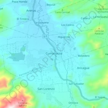
Naam: Topografische kaart Cumanacoa, hoogte, reliëf.
Locatie: Cumanacoa, Municipio Montes, Sucre, Venezuela (10.21044 -63.95984 10.29044 -63.87984)
Gemiddelde hoogte: 334 m
Minimale hoogte: 199 m
Maximale hoogte: 1.143 m