
Topografische kaart Chakan
Interactieve kaart
Klik op de kaart om de hoogte weer te geven.
Chakan
Shiroli Chandus village, located 6 km north of Chakan, had been identified as the probable site for the proposed Pune International Airport, but due to the protests by the villagers & uneven topography, the site has been shifted to Purandar.
Over deze kaart
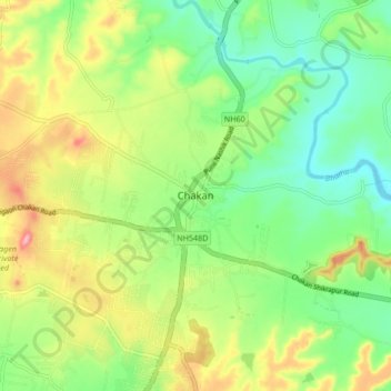
Naam: Topografische kaart Chakan, hoogte, reliëf.
Locatie: Chakan, Khed, Pune District, Maharashtra, 410500, India (18.72231 73.82254 18.80231 73.90254)
Gemiddelde hoogte: 624 m
Minimale hoogte: 568 m
Maximale hoogte: 712 m
Andere topografische kaarten
Klik op een kaart om zijn topografie, zijn hoogte en zijn reliëf te bekijken.