
Topografische kaart Santo Tomas
Interactieve kaart
Klik op de kaart om de hoogte weer te geven.
Over deze kaart
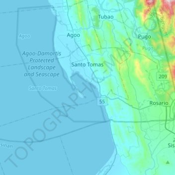
Naam: Topografische kaart Santo Tomas, hoogte, reliëf.
Locatie: Santo Tomas, La Union, Región de Ilocos, Filipinas (16.19263 120.20158 16.30898 120.44816)
Gemiddelde hoogte: 59 m
Minimale hoogte: -1 m
Maximale hoogte: 866 m