
Topografische kaart Campo de Criptana
Interactieve kaart
Klik op de kaart om de hoogte weer te geven.
Over deze kaart
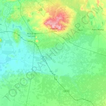
Naam: Topografische kaart Campo de Criptana, hoogte, reliëf.
Gemiddelde hoogte: 658 m
Minimale hoogte: 625 m
Maximale hoogte: 775 m
The 13th century beginnings of the urban center were situated around a fortified position in the Cerro de La Paz, which served as a defensive outpost of the Castillo de Criptana. The topographical features of the area determined the formation of the city and its subsequent expansion into the plain to the south.