

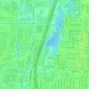
Topografische kaart Palm Springs
Klik op de kaart om de hoogte weer te geven.
Palm Springs
The original village townsite includes a chain of artificial north-to-south oriented lakes linked to canals, engineered in 1957 as a mechanism to promote drainage. Geologically, Palm Springs is located within the Anastasia Formation region, which dominates far eastern Palm Beach County. This type of geological formation is composed primarily of coquina, sand, and sandy limestone. The average elevation of Palm Springs is 10 ft (3.0 m).
Over deze kaart

Naam: Topografische kaart Palm Springs, hoogte, reliëf.
Gemiddelde hoogte: 9 m
Minimale hoogte: 1 m
Maximale hoogte: 11 m
Andere topografische kaarten
Klik op een kaart om zijn topografie, zijn hoogte en zijn reliëf te bekijken.





Delray Beach
United States > Florida > Palm Beach County > Delray Beach
Delray Beach has hot and humid summers. High summertime temperatures range from 87-93 °F with low temperatures around 75-78 °F. Winters are warm, with a marked drier season. Typical wintertime high temperatures are typically in the range of 74-83 °F and low temperatures 57-65 °F. However, when occasional…
Gemiddelde hoogte: 4 m







Villages of Oriole
United States > Florida > Palm Beach County > Villages of Oriole
Gemiddelde hoogte: 9 m

Oslo national park
United States > Florida > Palm Beach County > West Palm Beach
Gemiddelde hoogte: 9 m