
Topografische kaart Mata Utu
Interactieve kaart
Klik op de kaart om de hoogte weer te geven.
Over deze kaart
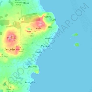
Naam: Topografische kaart Mata Utu, hoogte, reliëf.
Locatie: Mata Utu, Uvea, Wallis and Futuna, 98600, France (-13.32204 -176.21402 -13.24204 -176.13402)
Gemiddelde hoogte: 25 m
Minimale hoogte: 0 m
Maximale hoogte: 150 m