
Topografische kaart Brandilanes
Interactieve kaart
Klik op de kaart om de hoogte weer te geven.
Over deze kaart
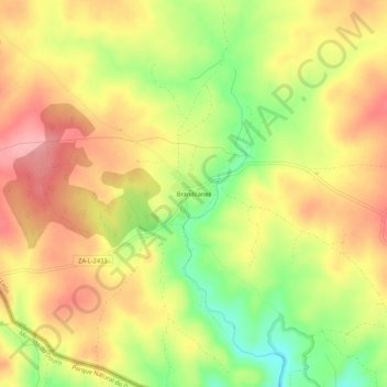
Naam: Topografische kaart Brandilanes, hoogte, reliëf.
Locatie: Brandilanes, Zamora, Castilla y León, 49513, España (41.60022 -6.23085 41.64022 -6.19085)
Gemiddelde hoogte: 773 m
Minimale hoogte: 705 m
Maximale hoogte: 825 m