
Topografische kaart Muttangi
Interactieve kaart
Klik op de kaart om de hoogte weer te geven.
Over deze kaart
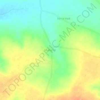
Naam: Topografische kaart Muttangi, hoogte, reliëf.
Locatie: Muttangi, Humanabad taluku, Bidar district, Karnataka, India (17.63820 77.30190 17.67820 77.34190)
Gemiddelde hoogte: 635 m
Minimale hoogte: 616 m
Maximale hoogte: 654 m