
Topografische kaart Quilotoa
Interactieve kaart
Klik op de kaart om de hoogte weer te geven.
Over deze kaart
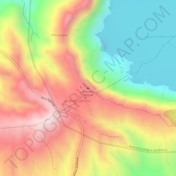
Naam: Topografische kaart Quilotoa, hoogte, reliëf.
Locatie: Quilotoa, Chugchillan, Sigchos, Cotopaxi, Équateur (-0.84920 -78.89713 -0.84910 -78.89703)
Gemiddelde hoogte: 3.553 m
Minimale hoogte: 3.326 m
Maximale hoogte: 3.827 m
Comme au Cotacachi, le volcan Quilotoa possède un lac auquel on accède par un chemin de randonnée (altitude 3 800 m).