
Topografische kaart Virgin
Interactieve kaart
Klik op de kaart om de hoogte weer te geven.
Over deze kaart
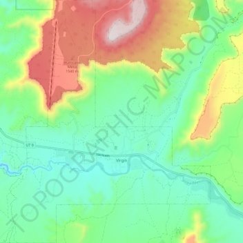
Naam: Topografische kaart Virgin, hoogte, reliëf.
Locatie: Virgin, Washington County, Utah, United States (37.17063 -113.25585 37.26243 -113.14567)
Gemiddelde hoogte: 1.251 m
Minimale hoogte: 1.003 m
Maximale hoogte: 1.758 m
Virgin is a town in Washington County, Utah, United States. The population was 596 at the 2010 census. The first settlement at Virgin was made in 1858. It is located along the Virgin River (for which it is named), and not far from Zion National Park. The elevation is 3,606 feet (1,099 m). It lies on State Route 9.