
Topografische kaart Ciudad Adolfo Lopez Mateos
Interactieve kaart
Klik op de kaart om de hoogte weer te geven.
Over deze kaart
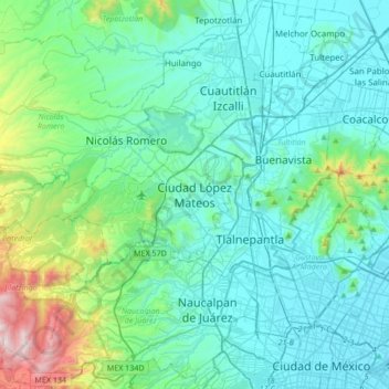
Naam: Topografische kaart Ciudad Adolfo Lopez Mateos, hoogte, reliëf.
Gemiddelde hoogte: 2.426 m
Minimale hoogte: 2.222 m
Maximale hoogte: 3.514 m
Its main elevations are Biznaga Hill, Atlaco Hill La Condesa Hill and Grande Hill.