
Topografische kaart Chautauqua Lake
Interactieve kaart
Klik op de kaart om de hoogte weer te geven.
Over deze kaart
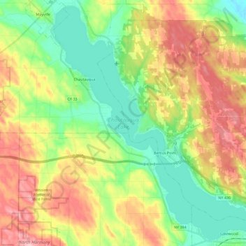
Naam: Topografische kaart Chautauqua Lake, hoogte, reliëf.
Gemiddelde hoogte: 463 m
Minimale hoogte: 384 m
Maximale hoogte: 575 m
Chautauqua Lake, at an elevation of 1,308 feet (399 m) above sea level, is higher than any of the Finger Lakes. It is also one of the highest navigable lakes in North America. The lake's water level is regulated by Warner Dam, with the water level lifted during the summer to allow for recreational boat use and lowered during the winter months.