

Topografische kaart Orcas Island
Klik op de kaart om de hoogte weer te geven.
Orcas Island
Orcas Island presents one of the most dramatic relief profiles in Washington’s San Juan Islands, rising abruptly from the sheltered waters of the Salish Sea to the summit of Mount Constitution, the archipelago’s highest point at about 2,409 feet (734 m). Its topography is strongly organized around steep, forested uplands in Moran State Park, where ridges, rocky slopes, and glacially influenced basins descend toward Cascade Lake, Mountain Lake, and the island’s deeply indented shores. East Sound forms a long, narrow marine depression that nearly divides the island, emphasizing Orcas Island’s rugged, irregular outline and creating a striking contrast between low coastal settlements such as Eastsound and the high central-eastern massif. Overall, the island has a compact but mountainous physical character, with sharp local elevation changes, wooded hills, enclosed valleys, lakes, and maritime edges combining to produce a landscape that feels both coastal and alpine.
Over deze kaart
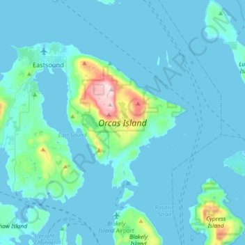
Naam: Topografische kaart Orcas Island, hoogte, reliëf.
Gemiddelde hoogte: 59 m
Minimale hoogte: -1 m
Maximale hoogte: 723 m
Andere topografische kaarten
Klik op een kaart om zijn topografie, zijn hoogte en zijn reliëf te bekijken.
