
Topografische kaart Swords
Interactieve kaart
Klik op de kaart om de hoogte weer te geven.
Over deze kaart
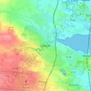
Naam: Topografische kaart Swords, hoogte, reliëf.
Locatie: Swords, Fingal, County Dublin, Leinster, K67 X8Y2, Ireland (53.41983 -6.25846 53.49983 -6.17846)
Gemiddelde hoogte: 28 m
Minimale hoogte: -19 m
Maximale hoogte: 80 m
At the northern end of the street stands Swords Castle, 200m northeast of the ecclesiastical site, which was built in the early 13th century. A short distance north of the Castle is the elevation known as Spittal Hill, where a hospital once stood.