
Topografische kaart Brimfield
Interactieve kaart
Klik op de kaart om de hoogte weer te geven.
Over deze kaart
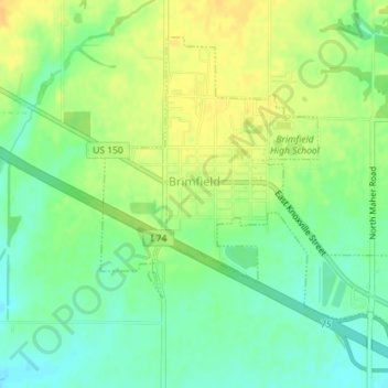
Naam: Topografische kaart Brimfield, hoogte, reliëf.
Locatie: Brimfield, Peoria County, Illinois, United States (40.82711 -89.89512 40.84897 -89.86568)
Gemiddelde hoogte: 213 m
Minimale hoogte: 199 m
Maximale hoogte: 226 m
Andere topografische kaarten
Klik op een kaart om zijn topografie, zijn hoogte en zijn reliëf te bekijken.
Peoria
United States > Illinois > Peoria County
Peoria, Peoria County, Illinois, United States
Gemiddelde hoogte: 189 m
Princeville
United States > Illinois > Peoria County
Princeville, Peoria County, Illinois, United States
Gemiddelde hoogte: 220 m
Peoria
United States > Illinois > Peoria County > Peoria
Peoria, Peoria County, Illinois, 61602-6199, United States
Gemiddelde hoogte: 196 m
Norwood
United States > Illinois > Peoria County > Norwood
Norwood, Peoria County, Illinois, United States
Gemiddelde hoogte: 200 m