
Topografische kaart Cairnhill Woods
Interactieve kaart
Klik op de kaart om de hoogte weer te geven.
Over deze kaart
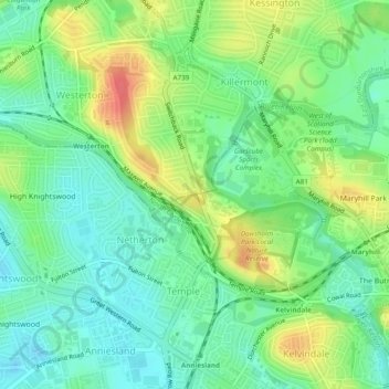
Naam: Topografische kaart Cairnhill Woods, hoogte, reliëf.
Gemiddelde hoogte: 39 m
Minimale hoogte: 17 m
Maximale hoogte: 75 m
Andere topografische kaarten
Klik op een kaart om zijn topografie, zijn hoogte en zijn reliëf te bekijken.
Forth and Clyde Canal Glasgow Spur Towpath
United Kingdom > Scotland > Glasgow City > Glasgow
Gemiddelde hoogte: 43 m