
Topografische kaart Ravensdale
Interactieve kaart
Klik op de kaart om de hoogte weer te geven.
Over deze kaart
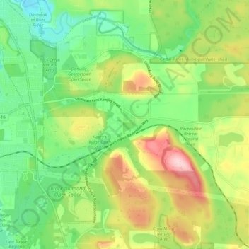
Naam: Topografische kaart Ravensdale, hoogte, reliëf.
Locatie: Ravensdale, King County, Washington, 98051, United States (47.33556 -122.01610 47.37635 -121.91712)
Gemiddelde hoogte: 209 m
Minimale hoogte: 112 m
Maximale hoogte: 366 m
Ravensdale is a census-designated place (CDP) in King County, Washington, United States. The population was 1,101 at the 2010 census. It is in the Pacific Time Zone. The elevation is 623 feet (190 m).