
Topografische kaart Santa Inés
Interactieve kaart
Klik op de kaart om de hoogte weer te geven.
Over deze kaart
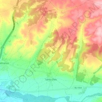
Naam: Topografische kaart Santa Inés, hoogte, reliëf.
Locatie: Santa Inés, Burgos, Castile and León, Spain (42.02471 -3.72051 42.08606 -3.65983)
Gemiddelde hoogte: 896 m
Minimale hoogte: 820 m
Maximale hoogte: 986 m