
Topografische kaart Churchill Falls
Interactieve kaart
Klik op de kaart om de hoogte weer te geven.
Over deze kaart
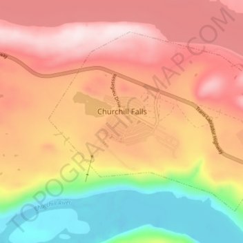
Naam: Topografische kaart Churchill Falls, hoogte, reliëf.
Locatie: Churchill Falls, Labrador, Neufundland und Labrador, Kanada (53.51561 -64.03141 53.54663 -63.96069)
Gemiddelde hoogte: 341 m
Minimale hoogte: 120 m
Maximale hoogte: 509 m