
Topografische kaart Adak
Interactieve kaart
Klik op de kaart om de hoogte weer te geven.
Over deze kaart
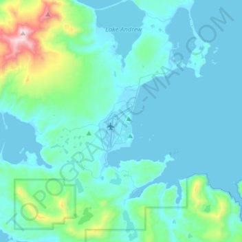
Naam: Topografische kaart Adak, hoogte, reliëf.
Gemiddelde hoogte: 141 m
Minimale hoogte: -6 m
Maximale hoogte: 1.169 m
Because of its naval aviation past, Adak has an unusually large and sophisticated airport for the Aleutian Islands. The airport is currently operated by the State of Alaska Department of Transportation. Complete with an Instrument Landing System, Adak Airport has no control tower and two 200' wide asphalt paved runways at 19' elevation. One runway measures 7,790' long while the other runway measures 7,605'. Alaska Airlines operates twice-weekly Boeing 737 passenger jet service from Anchorage via Cold Bay. At present, flights operate each Wednesday and Saturday, weather permitting. Occasionally, extra seasonal flights are operated to meet the demand of the fishing season.