
Topografische kaart Bhilai
Interactieve kaart
Klik op de kaart om de hoogte weer te geven.
Over deze kaart
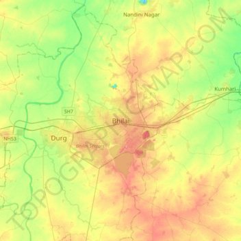
Naam: Topografische kaart Bhilai, hoogte, reliëf.
Locatie: Bhilai, Durg Tahsil, Durg, Chhattisgarh, 490023, India (21.05207 81.21328 21.37207 81.53328)
Gemiddelde hoogte: 292 m
Minimale hoogte: 255 m
Maximale hoogte: 335 m
Bhilai lies at 21.21°N 81.38°E in Central India at an elevation of 297m above sea level on the banks of the Shivnath river, a tributary of the river Mahanadi. It covers an area of 341 km² (132 sq mi).