
Topografische kaart Bradfordville
Interactieve kaart
Klik op de kaart om de hoogte weer te geven.
Over deze kaart
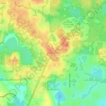
Naam: Topografische kaart Bradfordville, hoogte, reliëf.
Gemiddelde hoogte: 51 m
Minimale hoogte: 25 m
Maximale hoogte: 78 m
Bradfordville is an unincorporated community in northern Leon County, Florida, United States. It is 8 miles (13 km) north of Tallahassee and south of the Florida/Georgia state line by 8 miles (13 km) at the intersection of US 319 and County Road 0342 (Bannerman Road/Bradfordville Road). Elevation is 237 feet (72 m).