
Topografische kaart Hickory
Interactieve kaart
Klik op de kaart om de hoogte weer te geven.
Hickory
Lake Hickory was named after the City of Hickory and runs along its northern edge. The lake covers almost 4,223 acres (17.09 km2) with 105 miles (169 km) of shoreline. Full pond elevation is 935 feet (285 m). Lake Hickory is a reliable source of water for the Cities of Hickory and Conover and the Town of Long View, while also functioning as a recreation hub for boating, fishing, and other water based activities.
Over deze kaart
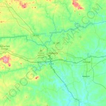
Naam: Topografische kaart Hickory, hoogte, reliëf.
Gemiddelde hoogte: 326 m
Minimale hoogte: 236 m
Maximale hoogte: 635 m
Andere topografische kaarten
Klik op een kaart om zijn topografie, zijn hoogte en zijn reliëf te bekijken.