
Topografische kaart Plitvice Lakes National Park
Interactieve kaart
Klik op de kaart om de hoogte weer te geven.
Over deze kaart
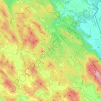
Naam: Topografische kaart Plitvice Lakes National Park, hoogte, reliëf.
Gemiddelde hoogte: 765 m
Minimale hoogte: 284 m
Maximale hoogte: 1.637 m
The afforested mountain slopes serve as water reservoirs. They are also a refuge for many animal species. The large difference in altitude in a narrow space between the mountains in the south and the Korana river in the north also represents a significant criterion for biodiversity in this region. The overall difference in altitude within the national park area is 912 m (the highest elevation is Seliški vrh at 1279 m, the lowest elevation is reached at 367 m at the bridge across the Korana river).