
Topografische kaart Walsh Point
Interactieve kaart
Klik op de kaart om de hoogte weer te geven.
Over deze kaart
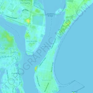
Naam: Topografische kaart Walsh Point, hoogte, reliëf.
Gemiddelde hoogte: 2 m
Minimale hoogte: -6 m
Maximale hoogte: 25 m
Andere topografische kaarten
Klik op een kaart om zijn topografie, zijn hoogte en zijn reliëf te bekijken.
Newcastle Harbour
Australia > New South Wales > Walsh Point
Newcastle Harbour, Pitt Street, Stockton, Walsh Point, Newcastle-Maitland, Newcastle City Council, New South Wales, 2295, Australia
Gemiddelde hoogte: 5 m
Civic Park
Australia > New South Wales > Walsh Point
Civic Park, Newcastle, Walsh Point, Newcastle-Maitland, Newcastle City Council, New South Wales, 2300, Australia
Gemiddelde hoogte: 9 m