
Topografische kaart Grande Prairie
Interactieve kaart
Klik op de kaart om de hoogte weer te geven.
Over deze kaart
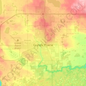
Naam: Topografische kaart Grande Prairie, hoogte, reliëf.
Locatie: Grande Prairie, Division No. 19, Alberta, Canada (55.11247 -118.96176 55.23618 -118.67955)
Gemiddelde hoogte: 665 m
Minimale hoogte: 600 m
Maximale hoogte: 726 m
Grande Prairie is located just north of the 55th parallel north, and is 465 km (289 mi) northwest of Edmonton, lying at an elevation of 669 m (2,195 ft) above sea level. The city is surrounded by farmland to the north, east, and west. To the south lies a vast boreal forest with aspen, tamarack, lodgepole pine, jack pine, and black spruce extending well into the foothills of the Canadian Rockies south and southwest of the city.