
Topografische kaart Crescent City
Interactieve kaart
Klik op de kaart om de hoogte weer te geven.
Over deze kaart
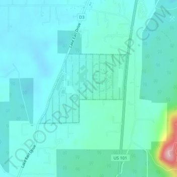
Naam: Topografische kaart Crescent City, hoogte, reliëf.
Locatie: Crescent City, Del Norte County, California, United States (41.84782 -124.16017 41.85846 -124.14190)
Gemiddelde hoogte: 31 m
Minimale hoogte: 2 m
Maximale hoogte: 203 m
The topography of the sea floor surrounding Crescent City has the effect of focusing tsunamis. According to researchers at Humboldt State University and the University of Southern California, the city experienced tsunami conditions 31 times between the years 1933 and 2008. Although many of these incidents were barely perceptible, eleven events included wave measurements exceeding one meter, four events caused damage, and one event in particular is commonly cited as "the largest and most destructive recorded tsunami to strike the United States Pacific Coast."
Andere topografische kaarten
Klik op een kaart om zijn topografie, zijn hoogte en zijn reliëf te bekijken.
Crescent City
United States > California > Del Norte County
Crescent City, Del Norte County, California, 75531, United States
Gemiddelde hoogte: 6 m
Craigs Creek
United States > California > Del Norte County
Craigs Creek, Del Norte County, California, United States
Gemiddelde hoogte: 356 m
Crescent City
United States > California > Del Norte County > Crescent City
Crescent City, Del Norte County, California, United States
Gemiddelde hoogte: 25 m