

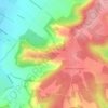
Topografische kaart Christmas Common
Klik op de kaart om de hoogte weer te geven.
Christmas Common
Christmas Common is a hamlet in Watlington civil parish, Oxfordshire about 7+1⁄2 miles (12 km) south of Thame in Oxfordshire, close to the boundary with Buckinghamshire. The hamlet is 812 feet (247 m) above sea level on an escarpment of the Chiltern Hills. Because of its elevation, Christmas Common has two radio masts that are prominent local landmarks.
Over deze kaart

Naam: Topografische kaart Christmas Common, hoogte, reliëf.
Gemiddelde hoogte: 192 m
Minimale hoogte: 112 m
Maximale hoogte: 260 m
Andere topografische kaarten
Klik op een kaart om zijn topografie, zijn hoogte en zijn reliëf te bekijken.
Watlington Hill
United Kingdom > England > Oxfordshire > South Oxfordshire > Watlington
Gemiddelde hoogte: 189 m