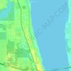
Topografische kaart Cocoa Beach
Klik op de kaart om de hoogte weer te geven.
Over deze kaart

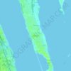
Naam: Topografische kaart Cocoa Beach, hoogte, reliëf.
Locatie: Cocoa Beach, Brevard County, Florida, United States (28.28587 -80.64337 28.37129 -80.60059)
Gemiddelde hoogte: 1 m
Minimale hoogte: -2 m
Maximale hoogte: 16 m
Andere topografische kaarten
Klik op een kaart om zijn topografie, zijn hoogte en zijn reliëf te bekijken.


Whispering Hills Golf Estates
United States > Florida > Brevard County > Titusville
Gemiddelde hoogte: 6 m

Cape Canaveral
United States > Florida > Brevard County
The hurricane of August 1885, pushed a "wall of water" over the barrier island (elevation, 3.1 m (10 ft)) devastating Cape Canaveral and adjacent areas. The ocean waves flooded the homesteaders and discouraged further settlement in the area. The beach near the lighthouse was severely eroded prompting its…
Gemiddelde hoogte: 1 m




Cape Canaveral
United States > Florida > Brevard County
The hurricane of August 1885, pushed a "wall of water" over the barrier island (elevation, 3.1 m (10 ft)) devastating Cape Canaveral and adjacent areas. The ocean waves flooded the homesteaders and discouraged further settlement in the area. The beach near the lighthouse was severely eroded prompting its…
Gemiddelde hoogte: 1 m


Georgiana
United States > Florida > Brevard County
Georgiana is a populated place located on Merritt Island in Brevard County, Florida at latitude 28.288673N and longitude 80.671398W. The elevation is 10 feet. It is about five miles south of the 520 Causeway, situated where the island is about a half-mile wide.
Gemiddelde hoogte: 1 m