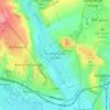
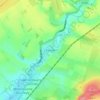
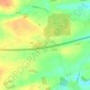
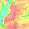
Topografische kaart Staverton
Klik op de kaart om de hoogte weer te geven.
Over deze kaart

Naam: Topografische kaart Staverton, hoogte, reliëf.
Locatie: Staverton, Wiltshire, England, United Kingdom (51.33370 -2.21879 51.34878 -2.19188)
Gemiddelde hoogte: 41 m
Minimale hoogte: 25 m
Maximale hoogte: 66 m
Andere topografische kaarten
Klik op een kaart om zijn topografie, zijn hoogte en zijn reliëf te bekijken.









Cley Hill
United Kingdom > England > Wiltshire > Corsley
Cley Hill (grid reference ST838449) is a prominent hill to the west of Warminster in Wiltshire, England. Its summit has a commanding view of the Wiltshire / Somerset county boundary, at 244 metres (801 ft) elevation. The land is in Corsley parish and is owned by the National Trust.
Gemiddelde hoogte: 157 m