
Topografische kaart Lubin
Interactieve kaart
Klik op de kaart om de hoogte weer te geven.
Over deze kaart
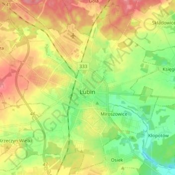
Naam: Topografische kaart Lubin, hoogte, reliëf.
Locatie: Lubin, Lubin County, Lower Silesian Voivodeship, Poland (51.35897 16.12963 51.43987 16.25825)
Gemiddelde hoogte: 140 m
Minimale hoogte: 105 m
Maximale hoogte: 179 m
Andere topografische kaarten
Klik op een kaart om zijn topografie, zijn hoogte en zijn reliëf te bekijken.
Lubin
Poland > Lower Silesian Voivodeship > Lubin County > Lubin
Lubin, Lubin County, Lower Silesian Voivodeship, Poland
Gemiddelde hoogte: 141 m