
Topografische kaart Boston Harbor Islands National Recreation Area
Interactieve kaart
Klik op de kaart om de hoogte weer te geven.
Over deze kaart
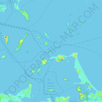
Naam: Topografische kaart Boston Harbor Islands National Recreation Area, hoogte, reliëf.
Gemiddelde hoogte: 1 m
Minimale hoogte: -2 m
Maximale hoogte: 47 m
Andere topografische kaarten
Klik op een kaart om zijn topografie, zijn hoogte en zijn reliëf te bekijken.
East Weymouth
United States > Massachusetts > Norfolk County > Weymouth
East Weymouth, Weymouth, Norfolk County, Massachusetts, 02189, United States
Gemiddelde hoogte: 21 m
Weymouth Heights
United States > Massachusetts > Norfolk County > Weymouth
Weymouth Heights, Weymouth, Norfolk County, Massachusetts, 02191, United States
Gemiddelde hoogte: 15 m