
Topografische kaart Devin
Interactieve kaart
Klik op de kaart om de hoogte weer te geven.
Over deze kaart
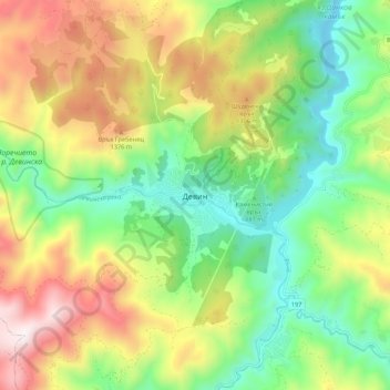
Naam: Topografische kaart Devin, hoogte, reliëf.
Locatie: Devin, Smolyan, 4800, Bulgaria (41.70336 24.35846 41.78336 24.43846)
Gemiddelde hoogte: 1.051 m
Minimale hoogte: 637 m
Maximale hoogte: 1.676 m
The Devinska river runs through it and numerous other brooks and rivers (namely Krichim, Muglenska and Trigradska) are found nearby, all tributaries of the Vacha river. The altitude is uneven owing to the mountainous location, ranging from 684 m to around 800 m above sea level.